|
Images Index> Matlock Bath, 20th and 21st Century Images> This page |


| Matlock Bath: River Derwent from Scarthin Rock |
| Matlock Bath : Twentieth Century Photographs, Postcards, Engravings & Etchings |
|
|||
The large property on the hillside is Woodbank and the hillside is known as Harp Edge. The hand coloured card is not quite an accurate depiction as we learn from an article about one of the farms on Cromford Moor that one of the views the farm enjoyed to the north was "the red roof of Woodbank amongst the dark foliage"[1]. The Reverend Richard Ward wrote in 1827: "On the left of the same entrance into the dale [i.e. from Cromford where the turnpike road had been blasted through Scarthin Rock] is a high and steep hill called Harp Edge : this is the termination of the lofty mountainous country, which bounds the whole valley of Matlock on its western side"[2].  1911-12
The message on this card reads "Another view from my bedroom window. You see Woodbank on the extreme right of the card". A pencilled additional note says:"(The grounds at Woodbank)". The photograph would have been taken for the Co-operative Holidays Association, a group who leased the house for a number of years from 1911 onwards.  Enlargement, to show Woodbank. Willesley Castle grounds are on the opposite side of the river. There appear to be headstones within the grounds. 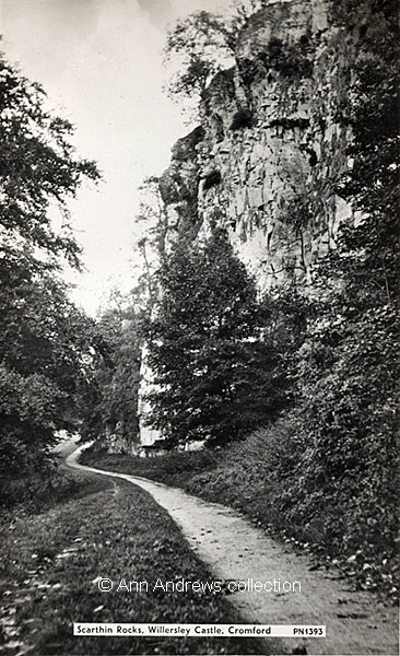 Scarthin Rocks. This card shows the same part of the Rocks as the previous image, but from the opposite direction. The River Derwent is to the left slightly lower than the path. Benjamin Bryan described the Rocks in 1903. |
|||
Images: 1. "The River Derwent from Willersley Road, Matlock Bath". Derbyshire "Artistic" Series, G Marsden & Son, Wirksworth and London, No.1998. Posted 12 Sep 1919 at Wirksworth. Personal message not relevant to picture. Another version of this card was posted in 1906. 2. & 3. [Woodbank - from Scarthin Rocks]. Published by Hirst, Photo, Birch Vale, via Stockport, Ref: M. J. Written and posted the same day, 10 Nov 1912, at Matlock Bath. 4. "Scarthin Rocks, Willerley Castle, Cromford". No publisher. No. PN1393. This is a real postcard. Unused. Images © Ann Andrews collection. Information researched, written by and © Ann Andrews. Intended for personal use only. |
|||
|
[1] "Derbyshire Advertiser and Journal", 13 October 1911. This was George Taylor's farm, leased from F. C. Arkwright of Willersley Castle. [2] Ward, Reverend Richard (1827) "The Matlock, Buxton and Castleton Guide, containing concise accounts of these and other remarkable places ... in the ... County of Derby", Derby [3] Bryan, Benjamin (1903) "History
of Matlock - Matlock, Manor and Parish", London by Bemrose & Sons,
Limited. |


